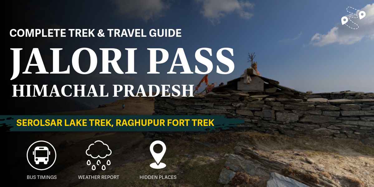
Jalori Pass sits at 3,120 meters, connecting the Kullu Valley to Shimla. It’s one of the lowest motorable passes in the Indian Himalayas, which means you can drive right up to it. No trekking required just to see it.
That’s part of why it works for almost anyone. Families, first-time trekkers, people who want a day out without training for weeks beforehand. And if you do want more, there’s a proper trek waiting a few kilometers past the road.
Table of Contents
Who this trip is for
You don’t need trekking experience to enjoy Jalori Pass itself. The drive up, the temple, and the view: that’s a complete visit for plenty of travelers.
If you want the Serolsar Lake trek, plan on moderate fitness. It’s 5 km one way, mostly gradual, with one genuinely steep stretch. Fit beginners manage it fine. Kids over 10 or so, with reasonable stamina, generally do okay too, though the walk back can drag for younger ones.
Raghupur Fort is shorter but steeper, closer to a real workout for the last stretch. If you’ve got limited time and have to pick one, Serolsar Lake gives you more to see for the effort. Raghupur Fort gives you a harder climb and a quieter trail, since fewer people bother with it.
Neither trek needs technical gear. Good shoes, a light daypack, water. That’s the bar.
Where is Jalori Pass
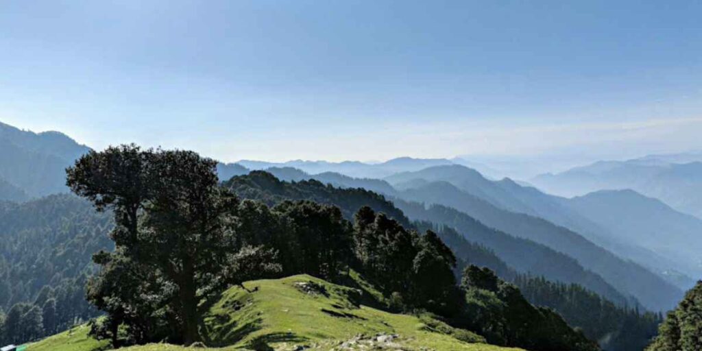
Jalori Pass is in the Kullu district, Himachal Pradesh, in the Banjar valley. It marks the boundary between the Kullu and Shimla regions, so you’ll see it described as a gateway between the two.
Shoja sits 5 km away. Banjar is 20 km. If you’ve read our Shoja guide, you already know the region. Jalori Pass is the natural next stop from there.
How to reach Jalori Pass
By road. This is how almost everyone gets here. The pass is on a motorable road, so a taxi or your own vehicle takes you straight to the top.
From Delhi: Delhi to Chandigarh to Mandi to Aut to Banjar to Jalori Pass. Roughly 500 km, 12-14 hours. Same route as reaching Shoja, since Banjar is the shared gateway town.
From Chandigarh: About 230-250 km, 7-8 hours.
From Jibhi: Around 12 km, 30-40 minutes. Jibhi is one of the closest bases if you want to do the pass as a day trip rather than staying up top.
From Shoja: 5 km, 20-30 minutes by road, or a short trek if you’d rather walk it.
By air. Bhuntar Airport, about 60-64 km away. Figure on 2-2.5 hours by road from there.
By train. No direct line. Joginder Nagar is the closer station on paper (around 125 km), but it’s narrow-gauge with limited service. Chandigarh is the more practical choice for onward connections, even though it’s farther out. Check current schedules on Indian Railways’ inquiry system before you plan around either.
One thing that catches people out: the road closes with heavy snow, typically December through February, sometimes reopening only in March. If you’re planning a winter trip, check current road status before you commit, not after you’re already at Banjar.
How far is it from major places
| From | Distance | Time |
|---|---|---|
| Shoja | 5 km | 20-30 min |
| Jibhi | ~12 km | 30-40 min |
| Banjar | 20 km | 45-60 min |
| Kullu | 73 km | 2.5-3 hours |
| Mandi | 79 km | 2.5-3 hours |
| Manali | ~90-100 km | 3-4 hours |
| Chandigarh | ~230-250 km | 7-8 hours |
| Delhi | ~490-500 km | 12-14 hours |
| Bhuntar Airport | ~60-64 km | 2-2.5 hours |
| Joginder Nagar Railway Station | ~125 km | Limited connectivity |
What to do at Jalori Pass
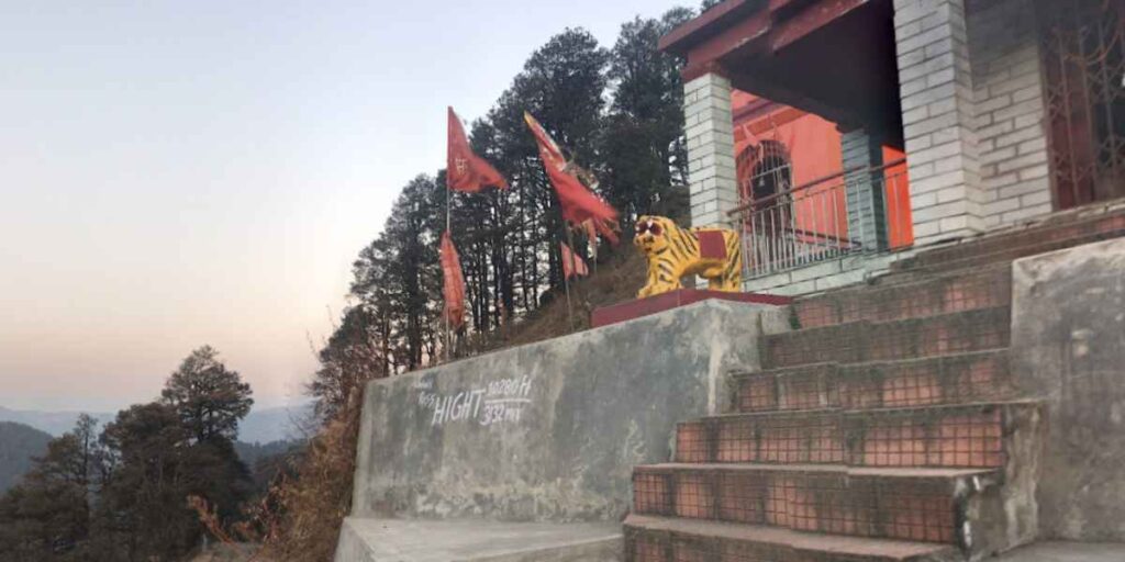
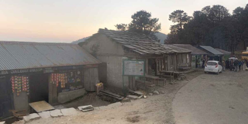
You don’t need to trek to enjoy the pass itself. The Mahakali Temple sits right at the top, a working shrine that draws pilgrims as much as travelers. Stop, look around, and get a tea from one of the dhabas. That’s a complete visit for a lot of people.
If you want more, three trails start from here.
The Serolsar Lake trek, step by step
This is the trail most people come for, so it’s worth walking through in real detail instead of just saying “5 km, easy to moderate.”
The trek starts near the Mahakali Temple at the top of the pass, right by a small tea stall. Two route options branch from here: one via Banjar Road and one starting near the temple itself. Both work. The temple route is the more commonly used one.
The first 10-15 minutes are flat, almost a warm-up. You’ll pass a nature camp on your right.
Around the 20-30 minute mark, you hit the first real landmark: two small cafes with green benches, sitting in a clearing with a wide valley view. This is also where the trail splits into an upper and lower path that rejoin later. Take the lower one on the way in; it’s wider with an easier descent. Take the upper one on the way back; it’s a gentler climb than the alternative.
From here, the trail moves through dense oak, deodar, and pine forest for most of the remaining distance. It’s genuinely one of the more scenic stretches: thick canopy, filtered light, birdsong, the occasional clearing to catch your breath.
The 360-degree viewpoint detour breaks off from the main trail after the first clearing. It’s a steep 30-45 minute round trip, the only real climb on this whole route. Worth it if you have the time: Pir Panjal to the north and the Great Himalayan range to the other side.
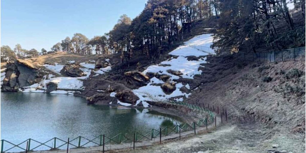
The final stretch takes you down a set of rock-cut stairs, and that’s your first glimpse of the lake. Total trek time runs 2-3 hours each way depending on pace and how many stops you take, so budget 4-6 hours round trip if you’re doing the viewpoint detour too.
At the lake itself: it’s smaller than most people expect, more pond than lake, but the setting does the work: dense pine forest ringing the water and the small Budhi Nagin temple right beside it. A narrow track and fence run around the perimeter. A few tent-style food stalls operate near the lake in season, mostly instant noodles and basic meals, though don’t count on them being open outside peak months.
The legend of Budhi Nagin
Locals consider this a sacred site, not just a scenic one. The lake is believed to be the home of Budhi Nagin, a serpent goddess said to guard its waters. Local lore holds she lives in a golden palace beneath the surface, and that disturbing the lake risks her anger, which is part of why the area around it stays so undisturbed.
Every Saturday, locals from surrounding villages make the trek up to perform parikrama, walking a circuit around the lake, offering ghee and oil at the temple. If your visit happens to fall on a Saturday, you’ll likely see this happening, and it’s worth pausing for rather than treating as background scenery.
Raghupur Fort trek
Shorter and steeper than the Serolsar route, roughly 2-3 km one way. The fort itself is a ruin now, built by a former Kullu king, with walls that still show bullet marks from old sieges and wide trenches surrounding the structure.
The climb is the harder part of this one: a real, sustained ascent rather than the gradual walk to Serolsar Lake. Once you’re up, the views over the Tirthan valley and the Pir Panjal range are the payoff. Fewer people do this trail, so it’s a quieter option if you’d rather avoid the crowds Serolsar Lake sometimes draws on weekends.
The 360-degree viewpoint
Covered above as a detour, but worth calling out on its own if you’re short on time. A steep 45-minute round trip from the main trail junction gets you the widest panorama on offer here without committing to the full Serolsar Lake distance.
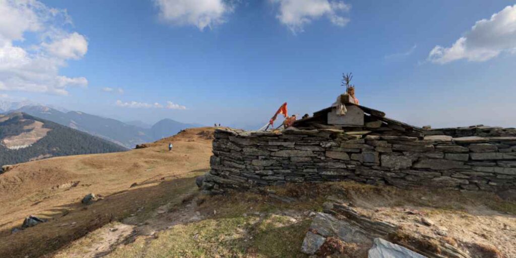
Best time to visit Jalori Pass, month by month
April to June: Prime season. Snow has mostly cleared from the trails by mid-April; temperatures sit comfortably in the 10-20°C range, and the forest is at its greenest. Wildflowers start showing up toward May-June. This is when most people visit.
July to August (monsoon): Skip this window unless your dates are genuinely fixed. Roads to Banjar and beyond see landslide risk, and the trek trails turn slippery. The lake and forest look striking in the rain, but it’s not worth the safety tradeoff for most travelers.
September to November: The second prime window, arguably the better one for views. Clear skies, cooler air, and the forest shift into autumn color by October-November. Fewer crowds than the April-June rush too.
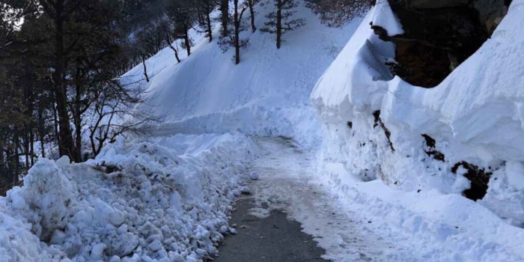
December to February: Heavy snow, sometimes 15-20 feet at the summit. The road frequently closes entirely, reopening around March. If you do make it up during a clear winter window, the scenery is dramatic, but this isn’t a season for casual visitors or first-time trekkers. Both the Serolsar Lake and Raghupur Fort trails become genuinely difficult, not just cold.
Where to stay
Shoja is the main base, 5 km out, with the widest range of homestays and guesthouses (see our Shoja stay guide). Jibhi works too, slightly farther but with more options overall. There’s also a forest rest house and a PWD rest house right at the pass, though these need advance booking and aren’t always reliably available online.
Camping near Serolsar Lake itself is restricted, but a short walk beyond the lake leads to a clearing where tents are allowed.
What to pack
- Layered clothing, even in summer, since temperatures drop fast once the sun goes down at this altitude
- Comfortable, broken-in trekking shoes with grip, not sneakers
- A light raincoat or poncho, especially outside the dry months
- Sunscreen and a hat: sun exposure is stronger than it feels at altitude
- A refillable water bottle; carry more than you think you need, since shops on the trail aren’t reliable
- Basic snacks for the trek; the food stalls near the lake aren’t guaranteed to be open
- A power bank, signal is patchy and phones drain faster in the cold
- Cash, see below
- A small first-aid kit if you’re the type who wants one; the trails are remote enough that it’s a reasonable precaution
Good to know before you go
No permits needed for Jalori Pass, Serolsar Lake, or Raghupur Fort. If your trip extends into the Great Himalayan National Park proper, that’s a separate permit through the park authorities.
The mobile network is patchy. BSNL and Jio work better than other carriers in this pocket, but don’t count on a signal during the treks themselves.
There are no ATMs at Jalori Pass, Shoja, or Jibhi. Carry cash. Banjar has the nearest ATMs, about 20-25 km out.
FAQs
Where is Jalori Pass?
Jalori Pass is a mountain pass in the Kullu district, Himachal Pradesh, at 3,120 meters, connecting the Kullu Valley to the Shimla region.
How do I reach Jalori Pass?
By road, via Banjar. From Delhi it’s roughly 500 km and 12-14 hours; from Chandigarh, about 230-250 km and 7-8 hours. The pass is motorable, so no trekking is required to reach the top itself.
How do I reach Jalori Pass from Delhi?
Delhi to Chandigarh to Mandi to Aut to Banjar to Jalori Pass is around 500 km and 12-14 hours by road. Most people break the trip with an overnight stop in Aut or Banjar.
How do I reach Jalori Pass from Jibhi?
About 12 km, 30-40 minutes by road.
How does Jalori Pass connect Kullu and Shimla?
It’s a motorable pass that forms a direct road link between the Kullu Valley and the Shimla region, making it a shortcut for travelers moving between the two without a long detour.
Is the Serolsar Lake trek difficult?
No, it’s rated easy to moderate. Most of the 5 km trail is gradual, with one steeper stretch near the 360-degree viewpoint detour. Fit beginners handle it without trouble.
Do I need a permit to trek to Serolsar Lake or Raghupur Fort?
No permit is needed for either trail or for Jalori Pass itself. Permits only apply if you’re entering the Great Himalayan National Park.
1 thought on “Jalori Pass: Complete Trek & Travel Guide”